
How To Get Detailed GPS Information On Your Android Device With GPS Status
Introduction
The benefits afforded to us by GPS for navigation and location purposes are boundless and many persons use their device’s navigation every day for navigation purposes.
There may be instances where you might want to see more information. The perfect app for giving you the detailed GPS information you’re looking for is GPS Status. It gives quite the detailed readout going so far as to give the magnetic field declination of your area.
How It Works
GPS Status doesn’t only give GPS information, it includes information from the other sensors from your phone as well.
We will be focusing on the free version today which has two screens which users can toggle between. First is the Status screen which displays detailed location data as well as data from sensors and there is the Radar screen which displays mainly location data.
Status
The Status screen is divided into three parts. These are the sky grid, the signal strength bar and the instrument panels.
Sky Grid
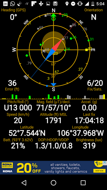
The sky grid is outlined in the screenshot below.

Satellites in the sky above you are displayed on the sky grid. Circles numbered from 1-32 are used to represent GPS satellites while rectangles numbered from 65-92 are used to represent GLONASS satellites. The larger these shapes are, the larger the corresponding signal strength. Color is also used to relay information to the user about satellites.
Green indicates that a satellite is currently being used to determine the location of your device. Yellow means that information from the satellite in question is available but it is not being used to determine your location. Blue means that approximate data is available while grey tells us that data from that satellite is not available.
The more satellites your device is locked onto the higher the accuracy of the data displayed. At the time of taking this screenshot, my device was locked on to 6 satellites. The developer states on his/her website that usually 4 satellites are required for a GPS lock.
There is a compass needle located at the center of the sky grid which can fairly accurately determine your heading.
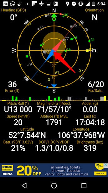
You must be wary however of factors which could affect how your device detects the earth’s magnetic field such as the steel found in buildings and vehicles.
GPS Status automatically makes the conversion from the magnetic heading that the phone reads to the true heading so that you do not have to worry about doing this.
Instrument Panels
Some of the instrument panels are self explanatory but some aren’t, so I will highlight them below.
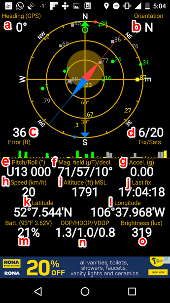
I have labelled each panel with a letter and their function is as described below:
- Heading (a): Direction device is facing
- Orientation (b): Compass direction of phone
- Error (c) : Shows error in location co-ordinates
- Fix/Sats (d): Number of satellites
- Pitch/roll (e): Describes tilt of phone about its 3 axes
- Mag. field (uT)/dec. (f): Strenght of magnetic field/magnetic declination angle
- Accel. (g): Acceleration device is moving at
- Speed (h): Speed device is moving at
- Altitude (i)
- Latitude (k)
- Longitude (l)
- Batt. (m)
- DOP/HDOP (n): Indicates how optimal the constellation of satellites is. The smaller the value the better
- Brightness (o)
My LG Nexus 5 doesn’t have all of the possible sensors that GPS Status can read data from but if you want to see the full capabilities of this wonderful app and the number of sensors it supports please visit the developer’s website.
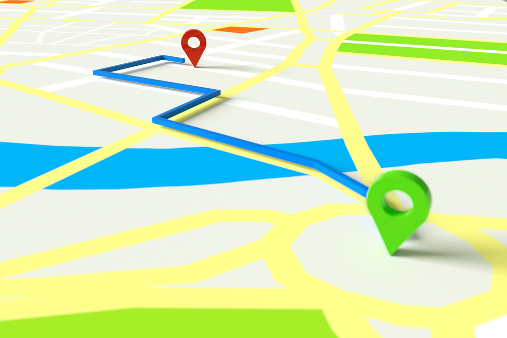
Radar
Radar allows you to navigate back to a saved location.
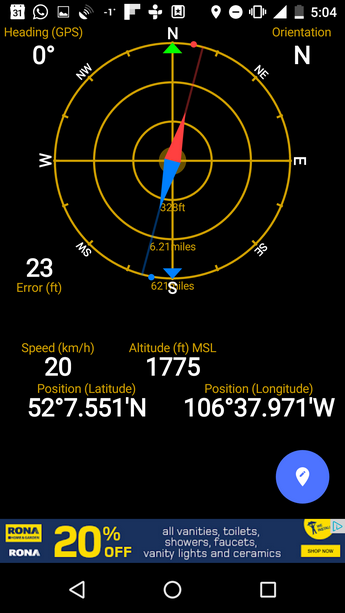
With this feature, you can save a location and navigate back towards it using your device’s compass and GPS.
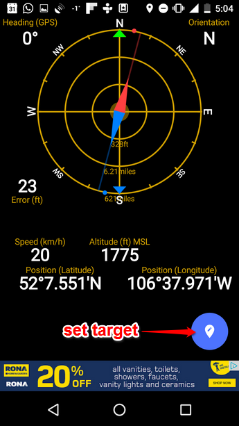
This app has a wealth of useful features, but the radar functionality stands out. It can come in quite handy if you get lost hiking or it would be useful in a much less worrying situation such as finding your car in a crowded parking lot.
You should give this app a look up if you can, and maybe you’ll have better luck finding your car in the parking lot next time. The sensor information could also be quite useful and could be used in personal experiments. For example, you may be biking and may want to get an idea of how fast you’re going.
The wealth of information displayed by this app provides a wealth of possibilities, many of which I am positive we haven’t even covered.