


How to See Elevation on a Google Map
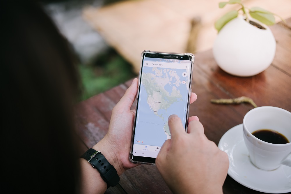
When we hear “maps”, we think Google Maps. At least that’s the case for most of us. Who even remembers unfolding a quilt-sized sheet of paper to look for directions? That said, they do still exist as an analog alternative when technology fails. Only we’ve gotten used to the reliability of something as useful as Google Maps, and we expect it to deliver.
Apart from being able to know exactly where we are at any given moment, and the distance we need to walk, drive, or travel to, Google Maps offers many other neat features. Such as being able to see the elevation of the route we’re taking.
Where Is It on a Map?
The first thing you need to do is figure out where you want to go and the means of transportation you’re using. The elevation information is only relevant for cyclists and pedestrians, so you probably know the exact route you want to take. What you need to do is this:
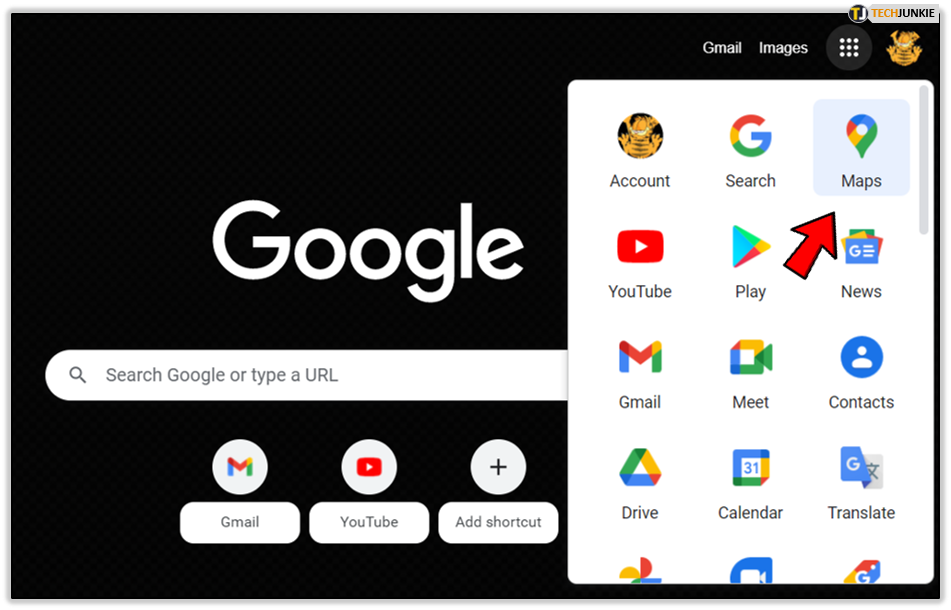
- Open Google Maps on your desktop.

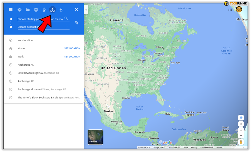
- Select the icon for cyclists or the pedestrian.

- And in the search box type in your starting location.

- Then proceed to type in your destination.

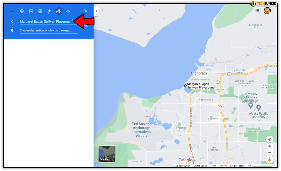
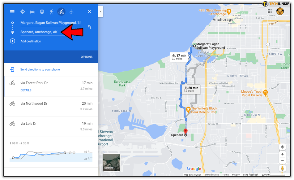
Whilst Google Maps shows you the map and the directions on the right of the screen, on the left side you’ll see all the potential routes you can take to get to your destination. This way you’re able to properly assess which one is optimal and go forth.
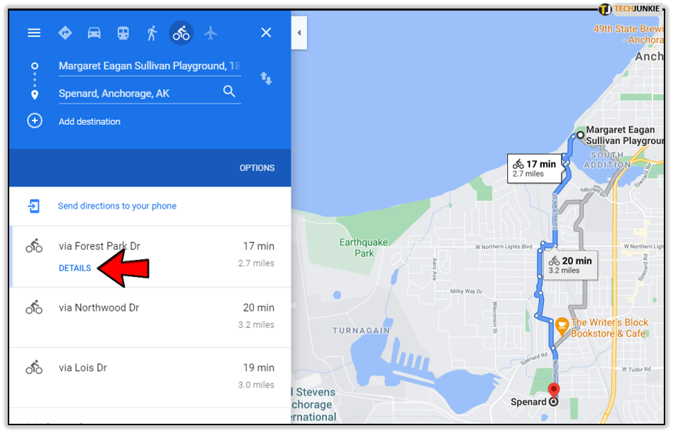
Ok, but how to see elevation on a Google Map? After you choose the preferred route, click on “details” and you’ll immediately be able to spot a graph that outlines the altitudes you’ll encounter on your way. You’ll also be able to follow the change in elevation as the route progresses. But, it’s good to keep in mind that it’s only the more significant changes in elevation that are displayed and that the distance can sometimes be slightly off.
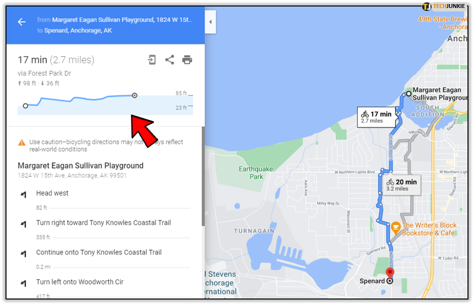
One of the really great features Google Maps offers in terms of elevation or altitude and cycling, is that it suggests when to stop cycling and walk your bike. Naturally, it’s just a suggestion, but for professional cyclists that might just be the challenge they’re looking for. Either way, it’s good to be aware of what’s ahead. The chart will also show the lowest and highest elevation point. If there aren’t any major elevations, it will just say “mostly flat”.
What Else Is It Good for?
We already mentioned that knowing how to see elevation on Google Map is handy for those who cycle professionally, as well as for those who don’t, but who else can benefit from this feature? This isn’t only relevant for long-distance hikers and cross-country cyclists. To move around a big city, especially one you don’t know well, can be problematic if you’re a person with a disability. The importance of knowing your terrain in advance can’t be overstated when special needs have to be met. To avoid certain areas or to be well prepared for them, either way – this feature does become a very useful one.
Other Useful Stuff
Useful is Google Maps first and second nature. We’re able to see what a place looks like before visiting it, and Google Street View is a tool that gives us a close enough feeling of actually being anywhere in the world. Here’s the exact distance to the next gas station, and if you miss that one, Google Maps will tell you where the next one is. Another really huge thing when traveling and unsure about internet access availability or if you don’t want to spend data internationally, is the offline version of Google Maps. Just to be on the safe side, it’s probably best to download the map after you type in your destination along with all the directions. Odds are you won’t regret it.
Cyclists Need It the Most
Google Maps has proven to indispensable when it comes to driving, and that’s amazing. But, having the elevation info available makes all the difference for those who cycle and for those who hike. When you’re planning a long-distance cycle, it’s easy to forget that not everything is a flat line like it seems in on the map. Some hills are very long and steep, and going downhill too fast can be dangerous. Knowing in advance when to get off the bike and be safe and not over-exerted might be the push you needed to finally venture out.
Let us know what you think about the elevation feature in Google Maps in the comments section below.


One thought on “How to See Elevation on a Google Map”
Google maps in a browser on a PC includes the elevation profile in all bike navigations. This is weirdly inconsistent