

How to Show Country Lines in Google Maps
Google Maps is an invaluable tool for those who love exploring different regions, landscapes, and streets. You can virtually tour a Christmas market in Berlin while sitting at your home thousands of miles away. To better understand the geography of a region, Google Maps can display the borderlines of countries and states. This can also give you a better understanding of the political status of a particular border.
Understanding the Borderline Styles Used in Google Maps
Understanding the borders and how Google Maps follows different styles of denoting them based on geopolitics and border conflicts is essential. This method has been adopted to avoid controversies and refrain from hurting the sentiments of the local people.
Hence, the next time you search for a country or a state in Google Maps, you will understand why Pakistan’s borderline is shown differently from Canada’s.
- The undisputed international borders, like the one between the United States and Canada, are highlighted as a solid line.
- The disputed international borders, like the one between India and Pakistan, are not highlighted.
- Temporary boundaries such as Treaty and provisional borders are also shown as a dashed gray line.
- State or province borders, such as Maharashtra or California, are shown as thin, light gray dotted lines.
If you go to a country map without searching, you will not see any borders. You should see standard lines around each country, but they don’t signify border disputes, if any.
Faking or spoofing your location in Google Maps can also impact the borderline styles used by Google Maps. Depending on your country, the tool can show different borders for some disputed regions.
How to Show the Country or State Borders in Google Maps on the Web
It is a straightforward process to see the border of a country or state in Google Maps. Use the above pointers to quickly understand the difference in denoting them.
- Open your browser and go to Google Maps.
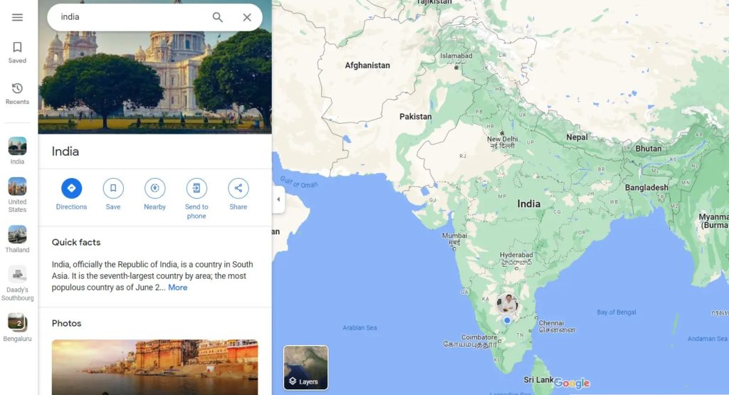
- In the search bar, enter the name of the desired country or state. In this case, I have used an example of a disputed and non-disputed border to show the difference.
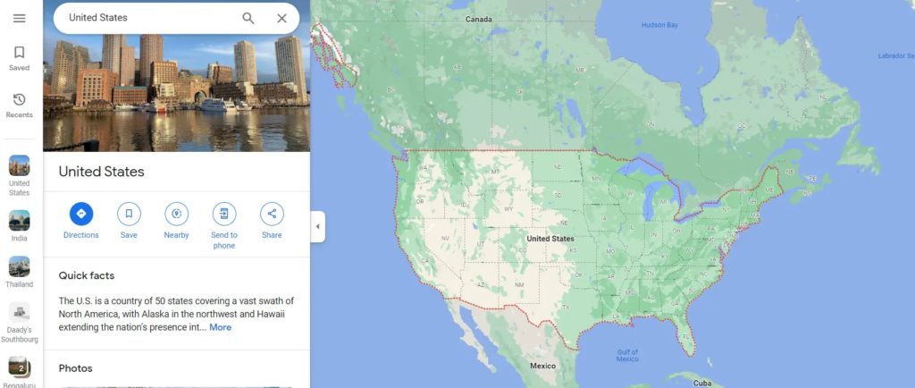
- In the screenshot below, we have searched for the United States, which falls in the non-disputed borders category. Hence, you can see a solid line highlighted around the borders.

- However, in the following screenshot, I have searched for India, which falls in the disputed border category. Hence, there is no solid line to denote the borders.

The experiences on Google Maps for Android or iPhone and the web are similar — the borders are shown similarly.
- Open Google Maps on your iPhone or Android device.
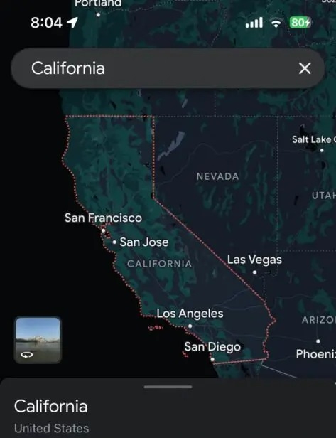
- Search for a country or a state in the search bar provided. In this case, we searched for California, which is a state in the United States of America.

- Since there’s no border dispute, California’s borderline is denoted by thin dotted lines.
According to documentation, State maps should be shown as thin, light-gray dotted lines inside a country.
If you are adding your business to Google Maps located near a border, these lines can be extremely helpful.
Mapping the Borders
Google Maps does a commendable job of avoiding controversies and lawsuits while also being able to provide us with accurate information. It is also possible to use Google Maps to measure distance, especially when traveling around the borders or in unknown countries.
FAQs
A: Google uses different colors and styles to indicate the boundaries of a country or a state in Google Maps. This is done to avoid confusion related to borders and dodge controversies.
A: Countries with disputed borders or the borderline agreed upon but not being followed by both countries by law will not have a borderline on Google Maps.